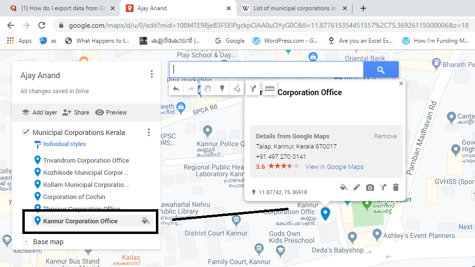
Places marked in Google Maps can be exported as KML files and these files can be viewed or edited in Excel or any other text editor.
Let me explain the process of adding 6 Municipal Corporations of Kerala to a personalized Map in Google and exporting that data into Excel
Login to google.com.mymaps
Click on Create a New Map
Add and Name a layer (Here I will name the Layer as Municipal Corporations Kerala)
Locate the places either manually or Type in the place name in the search bar
Once you have located the place click on the location on Map, Select Add to Map
If you want to see the list of added places, click on the 3 dot menu against the layer name and select Open Data Table
To export this data into Excel, Click on the 3 dot menu against the Map name > Select Export KML/KMZ
In the dialogue box for Export to KML/KMZ, Select the Layer Name instead of Entire Map > Mark the checkbox against the Label ‘Export as KML instead of KMZ’ > Click on Download
A KML file with the same layer name will be downloaded automatically. Either drag this file into an Excel or use Excel to open this KML file.
There will be a warning message, but click on Yes against the question ‘Do you want to open it anyway?’
In the next Dialogue for Open XML, Select ‘As an XML table’ and Click OK
The data table with Names and Coordinates of the places that were marked in Google Maps will be loaded as an Excel table.
